On 3rd March 2020, just two weeks before the government declared Movement Control Order (MCO) in response to the Coronavirus pandemic, we chose the best or worse weather (depending on how you look at it, but to me it was the best. Reasons after this) to climb Mt Serapi, the highest mountain within Kuching’s vicinity at 911m. This mountain is located within the perimeter of Kubah National Park.
Torrential monsoon season in Sarawak occurs usually in December lasting till mid-February, but often intermittently for half an hour or so, then stops or light drizzles for an hour or so, then starts again. But on 3rd March 2020, the timing of the start of the downpour was uncanny. The moment we paid our entrance fee and about to begin the trek, the sky opened up, granted the sky was already darkened with dark clouds even at 9.00am. Within minutes of our ascent, the torrent started. But my instinct, honed over 15 years of doing the outdoors, told me it would stop at most, after 30 minutes. How wrong I was this time.
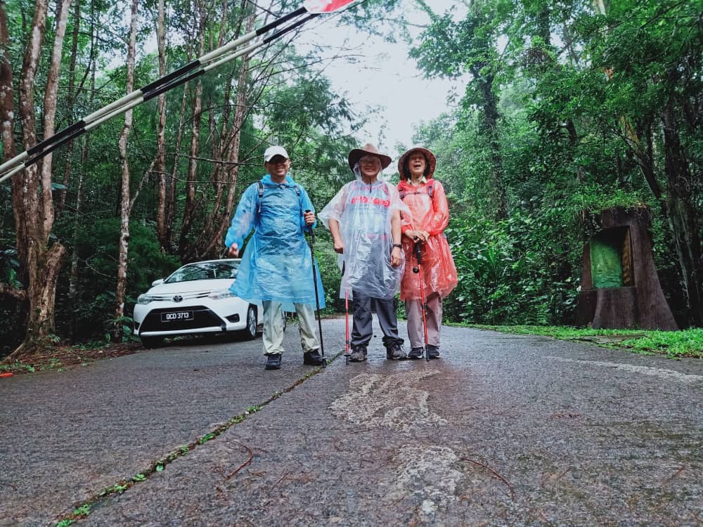
In fact the weather looked so bad that the forest warden at the reception told us that he had just turned away a group of foreign climbers intending to do the waterfall trail via the jungle path, as trekking in in inclement weather was dangerous. The reason we were allowed to continue was because the trail up to the viewing point atop Mt Serapi was a paved road all the way! And the trail was wide enough for 2 4-wheel drive vehicles to negotiate up and down, but is only restricted to the maintainance staff of the telecommunication tower on the summit. It is on this road that we trekked up to the summit and was thus relatively safe, but when the big rain started, the warden was already out of sight and too late to call us back, assuming he had wanted to. Anyway, the three of us, my two old school buddies, trudged on with scant regards for the rain as all of us were “seasoned outdoors veterans”.
I had experienced being soaked to the skin in outings before, and had we not brought our “raincoats”, this would be the mother of all soakings. The torrent that morning was unusual in that it hardly stopped the whole time we were trudging up the trail, maybe it slowed a bit, at one time reduced to a drizzle, then it started again. And this flimsy see-through plastic disguised as a raincoat didn’t help either, wearing a giant plastic bag for three hours no matter how cool the temperature is, was bound to create a humidity akin to walking in a sauna. So once we reach a point of unbearablity, we stopped at the many covered shelter and took them off to cool ourselves down.
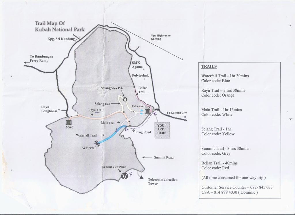
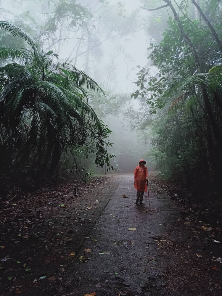
The trail took us about 4 hours (including stops) to complete. Along the way, there are covered shelter stops, each with indication of elevation. We saw the telco tower, which is a security restricted area, perched on the summit shrouded in swirling mists. A few hundred metres to the right is the dirt road leading to the viewing tower. Along the way, we saw a cable car for transport of provisions to the telco tower and some staff doing loading and unloading.
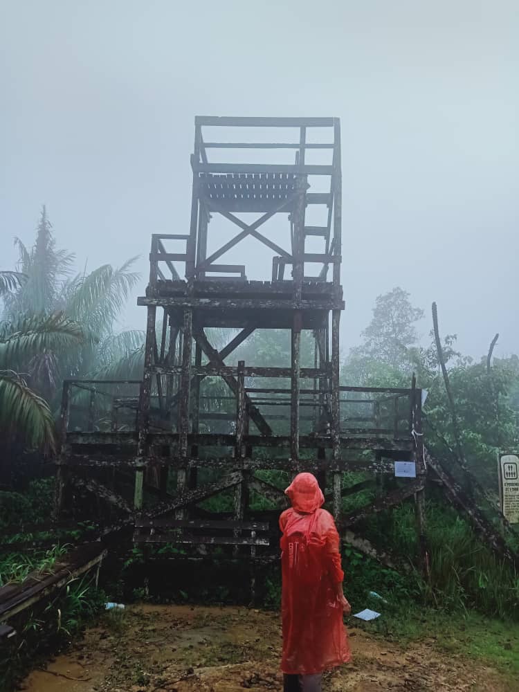
Unfortunately when we reached the viewing tower it was in a state of disrepair and a notice prohibited visitors to climb up. Decided not to push our luck, we just hang around the base and walked to another view point only to see the whole vista a sea of white nothingness, as mists or clouds block all views.
A highlight is an interesting fauna – an over a foot long earthworm lookalike with the thickness of a person’s finger which the forest warden told us is common in this park and is called a Caecilian worm.

All along the trek, the incline was rather gentle but we could feel we were like going up stairs. The trail was paved with cement and serrated to give traction for vehicles and shoes, so it was quite safe. This is the first time I had purposely done a trek in heavy rain, I mean we could have aborted within minutes of our ascent, but I guess we were just lucky to continue because it was definitely an outing that we will remember for a long time. Besides, I really love the dramatic photos of the wet landscape, the mists, the dark brooding giant trees as we laboured up the mountain, instead of the usual “blue sky and everything nice” photos.
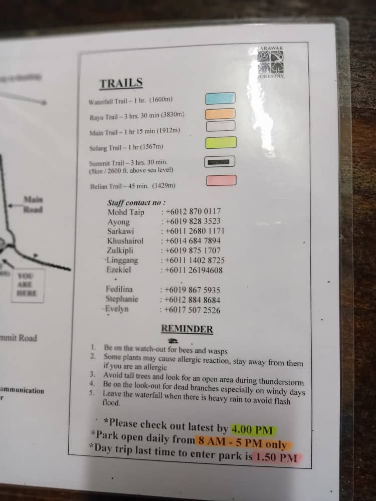
Facts box: Mt. Serapi is within the perimeter of Kubah National Park and is just a leisurely hour drive from the city. There are about 6 nature trails to choose from ranging from 45 minutes to over 3 hours. The most popular is actually the Waterfall trail. Kubah Ria is also home to a great spot for watching a dozen or so variety of exotic frogs, but this has to be done in the evening after dark, and with a guide. Accommodations are available for overnight, but there is little facilities so visitors has to bring enough food and water on their own.